Web Map Server Style Pages
Web Map Servers allow a little bit of control over how content is drawn. The Style Editor dialog makes use of the following pages when working with a WMS Layer.
The pages displayed depend on the configuration of the web map service you are using.
Simple
You can change a few simple settings on a WMS Layer. These settings control how the WMS Layer is intergrated into your Map.
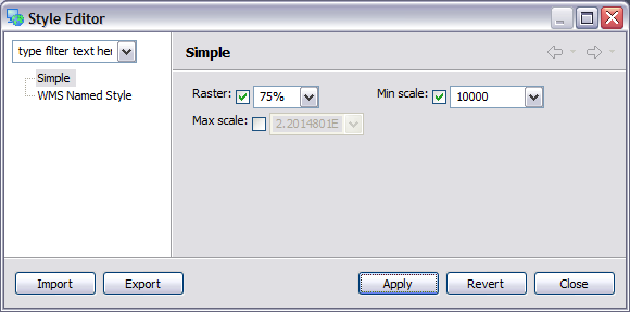
Raster
You can change the opacity of the resulting WMS Layer. The default value is 100%.
Min Scale
You can define the minimum scale for which this layer should be displayed. This is useful when shutting off layers that become pixelated when you zoom too close.
Max Scale
You can define the maximum scale for which this layer is displayed.
This is useful when working with a WMS Server which is slow when looking at too much content.
WMS Named Style
Web Map Servers sometimes publish a list of alternate stylee
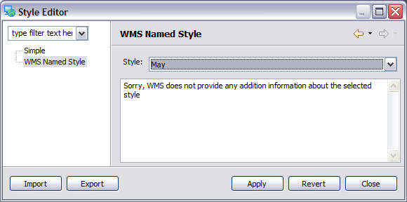
In the picture above the jpl nasa WMS is publishing the blue marble dataset broken up according to months of the year.
Style
Choose the named style from the available list.
Description
If the named style provides any sort of description it will be shown here.